A Living Heritage: City Streets and the Legacy of Early Settlers
Audio Tour
Audio Guía
Image Gallery
English
Español
-
Today’s bridges and street names contain hidden annals of San Antonio’s deep history.
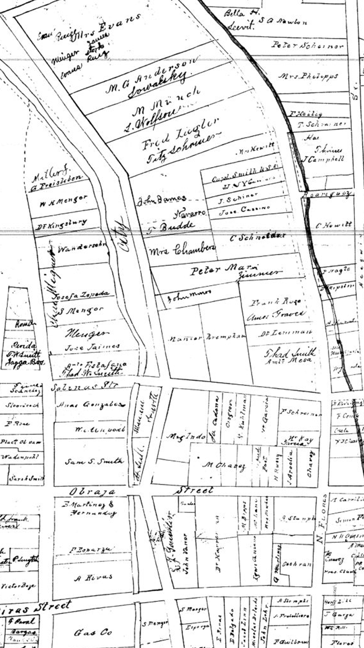
The streets and bridges that span San Pedro Creek define the modern city. But they also echo the legacies of the early settler families of New Spain who built their dwellings on land granted to them by Spanish authorities in the 1700s. Herencia (heritage) is alive here. These pioneer residents drew water from the creek and nearby acequia, a hand-dug irrigation channel that delivered water from San Pedro Springs to nearby fields and homes. Their descendants inherited irrigated farms and homesteads, which were sold and subdivided as the town prospered and grew outward from the creek banks in the mid-1800s. Early unpaved streets were named, in Spanish, to reflect landscape features and known landmarks of the era. Among this array of early streets were Acequia (for the irrigation channel), Campo Santo (for the burial ground west of San Pedro Creek), Nogales (for pecan trees growing near the creek), Obraje (for adobe workshops in the area), and Arroyo San Pedro (the street alongside the creek). As the city grew and populations shifted in size and influence, some street names were changed to commemorate prominent residents and historical figures.
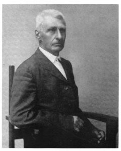
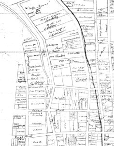
Source: Twentieth Century History of Southwest Texas, 1907. Campo Santo became Rivas, and Nogales was renamed Salinas–both recognizing influential families. Later, city streets would be renamed for heroes of the Texas Revolution, signalling shifting influence and power. Obraje became Travis Street in remembrance of William Barret Travis, commander of Texas troops at the Battle of the Alamo, and Rivas was changed to Houston Street to honor Sam Houston, the Texas army general who became the first president of the Republic of Texas. Though most of the adobe and stone buildings that served as tangible reminders of San Antonio’s past had disappeared by the 21st century, downtown street names still carry the memory of our city’s long, deep, and richly layered history.
Audio Tour
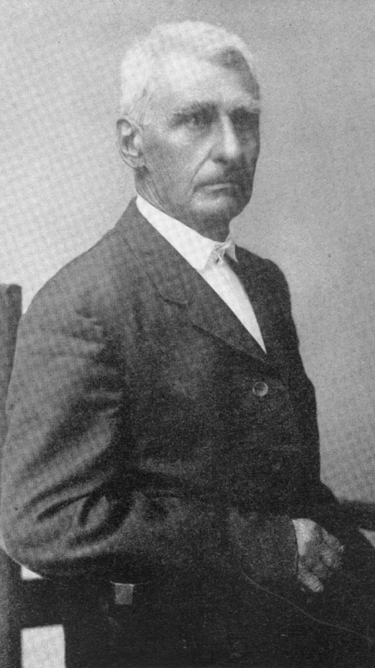
Longtime residents and visitors to San Antonio may recognize a theme while driving through the downtown streets. Travis, Houston, Alamo. These streets were named to honor the prominent people and events that shaped our city’s history. But before Travis Street was named after William Barret Travis, commander of Texas troops at the Battle of the Alamo, it was called Obraje, for the adobe workshops in the area. Houston Street wasn’t always named after Sam Houston, the Texas army general who became the first president of the Republic of Texas. Before then, the street was called Rivas to recognize an influential family of the time. And even before that, Rivas Street was called Campo Santo, for the burial ground west of San Pedro Creek. The city may look vastly different than the days of the native people or during the Battle of the Alamo, but herencia, or heritage, is alive here. The legacies of San Antonio live on so we may never forget our city’s long, deep, and richly layered history.Those who owned property and lived along the creek in this area included members of the Chávez, García, Garza, and Mojaras families. Prominent rancher Juan Antonio Chávez, who was born near San Pedro Creek in 1827 and died nearby on Obraje Street in 1911, witnessed the colonial town grow to become a modern city.
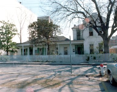
Mariano García and his wife, Tomasa Chávez, built their home on Nogales (later Salinas) Street in the middle 1850s. The house was enlarged as their family grew. It was the home of García’s foster grandson, Adolph Garza Jr., until 1981 when it was sold and converted into offices. The house is seen here as it appeared in the 1970s.
-
Los nombres actuales de puentes y de calles contienen referencias ocultas a la profunda historia de San Antonio.
Las calles y puentes que cruzan el Arroyo San Pedro definen la ciudad moderna. Pero también hacen eco de los legados de las primeras familias de colonos de Nueva España que construyeron sus viviendas en tierras que les fueron otorgadas por las autoridades españolas en el siglo XVIII. Aquí, la herencia sigue viva. Estos residentes pioneros sacaban agua del arroyo y de la acequia, un canal de riego excavado a mano que distribuía agua desde los Manantiales San Pedro a campos y casas cercanas. Sus descendientes heredaron residencias y granjas con irrigación, que se vendieron y subdividieron a medida que la ciudad prosperó y creció alejándose de las riberas del arroyo a mediados de 1800. Las primeras calles sin pavimentar fueron nombradas, en español, para reflejar las características del paisaje y los puntos de referencia de la era. Entre esta variedad de calles de la era temprana se encontraban Acequia (por el canal de riego), Campo Santo (por el cementerio al oeste del Arroyo San Pedro), Nogales (por los árboles de nuez pacana que crecían por el arroyo), Obraje (por los talleres de adobe del área), y Arroyo San Pedro (la calle junto al arroyo). Conforme la ciudad creció y las poblaciones cambiaron de tamaño e influencia, algunos nombres de las calles se cambiaron para conmemorar a los residentes prominentes y figuras históricas.

Source: Twentieth Century History of Southwest Texas, 1907. Campo Santo se convirtió en Rivas, y Nogales pasó a llamarse Salinas, ambos en reconocimiento a familias influyentes. Más tarde, las calles de la ciudad pasarían a llamarse como los héroes de la Revolución de Texas, lo que indicaría un cambio de influencia y poder. Obraje se convirtió en la calle Travis en recuerdo de William Barret Travis, comandante de las tropas de Texas en la Batalla del Álamo, y Rivas cambió a Houston Street para honrar a Sam Houston, el general del ejército de Texas que se convirtió en el primer presidente de la República de Texas. Aunque la mayoría de los edificios de adobe y piedra que servían como recordatorios tangibles del pasado de San Antonio desaparecieron para el siglo XXI, los nombres de las calles del centro de la ciudad aún conservan el recuerdo de la larga, profunda y rica historia de nuestra ciudad.
Audio Guía
Los residentes establecidos y los visitantes de San Antonio pueden reconocer un tema mientras conducen por las calles de la ciudad. Travis, Houston, Álamo. Estas calles fueron nombradas para honrar a las personas prominentes y eventos que dieron forma a la historia de nuestra ciudad. Pero antes de que la calle Travis fuera nombrada en honor a Guillermo Barret Travis, comandante de las tropas de Texas en la batalla del Alamo, se llamaba Obraje, por los talleres de adobe que había en esa área. La calle Houston no siempre fue nombrada en honor a Sam Houston, el general del ejército de Texas que se convirtió en el primer presidente de la República de Texas. Antes de eso, la calle se llamaba Rivas para reconocer a una familia de gran influencia de la época. E incluso antes de eso, la calle Rivas se llamaba Campo Santo, por el cementerio al oeste del Arroyo San Pedro. la ciudad puede parecer muy diferente a los días de los pueblos nativos o durante la Batalla del Álamo, pero aquí la herencia, o patrimonio, sigue viva. Los legados de San Antonio continúan viviendo, así que nunca olvidaremos la historia de nuestra ciudad, que es de muchos años, profunda y ricamente estratificada.Los que tenían propiedades y vivían a lo largo del arroyo en esta área incluían miembros de las familias Chávez, García, Garza y Mojaras. El prominente ranchero Juan Antonio Chávez, quien nació cerca del Arroyo San Pedro en 1827 y murió cerca de la calle Obraje en 1911, fue testigo de cómo la ciudad colonial se convirtió en una ciudad moderna.
Mariano García y su esposa, Tomasa Chávez, construyeron su casa en la calle Nogales (después Salinas) a mediados de la década de 1850. La casa se agrandó a medida que crecía su familia. Fue el hogar del nieto adoptivo de García, Adolph Garza Jr., hasta 1981, cuando fue vendida y convertida en oficinas. La foto muestra la casa en la década de 1970.

