facebook pixel Living and Working Along San Pedro Creek - San Pedro Creek Culture Park Skip to content

Living and Working Along San Pedro Creek

RECIPIENTS OF LAND GRANTS here along San Pedro Creek in the 1700s drew water for their households, gardens, and livestock from the creek and adjoining acequias (irriga􀆟on canals).
Image Gallery

Living and Working Along San Pedro Creek

Vivir y Trabajar Junto al San Pedro Creek

English
Español
  • Recipients of land grants here along San Pedro Creek in the 1700s drew water for their households, gardens, and livestock from the creek and adjoining acequias (irrigation canals). Early development to the west was clustered along the road to Laredo (Laredo Street) and to the east along Flores Street. Growth of the business district, beginning in the mid-1800s, transformed fields and neighborhoods along the creek, and by the 1890s a bakery, cotton gin, soap works, and tin shop operated in this area. When a railroad siding was built between the creek and Flores Street in the early 1900s, houses were demolished and replaced by multi-story manufacturing and warehouse facilities. Other lots were infilled with substandard tenements for workers and newly arrived Mexican refugees—dwellings removed by the Urban Renewal program beginning in the 1960s. Transformation of the creekside neighborhoods continued in the early 2000s, as industrial and commercial buildings were converted to modern housing units.

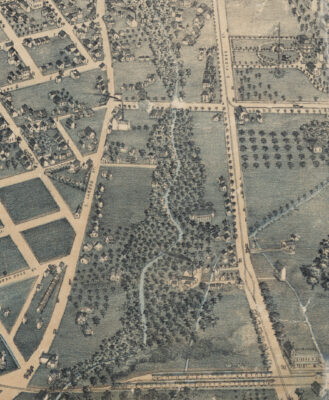
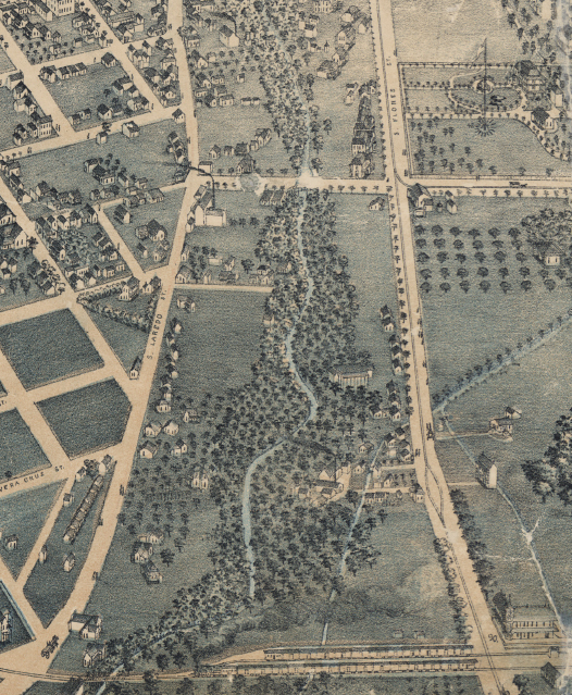
    Source: Augustus Koch, “Bird’s Eye View of San Antonio, Bexar Co. Texas 1886. Looking North East.”

    The Augustus Koch 1886 view of San Antonio illustrated both residential and early industrial facilities near San Pedro Creek. Two industries along the creek were Daniel Heder’s cotton gin (A) and Alcide Lachappelle’s soap factory (B).

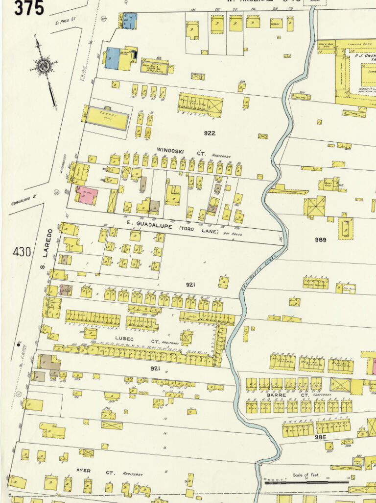
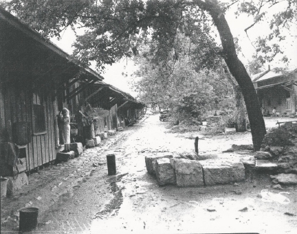
    Courtesy: Light Collection, University of Texas at San Antonio Libraries Special Collections.

    Long rows of tenement houses were built near San Pedro Creek in the early 1900s as illustrated on this 1912 Sanborn Insurance map. Residents of these substandard houses shared yards, water hydrants, and privies.

    Source: “Insurance Maps of San Antonio, Texas.”
    Sanborn Map Company, 1912.
  • Los beneficiarios de las adjudicaciones de suelos aquí a lo largo del San Pedro Creek en los años 1700 sacaban agua para sus hogares, jardines y ganado del arroyo y de las acequias (canales de riego) adyacentes. El desarrollo inicial hacia el oeste se agrupaba a lo largo de la calle Laredo (Laredo Street) y hacia el este a lo largo de la calle Flores. El crecimiento del distrito comercial, a partir de mediados del siglo XIX, transformó los campos y los vecindarios a lo largo del arroyo, y en la década de 1890 funcionaban en esta área una panadería, una desmotadora de algodón, una fábrica de jabón y una hojalatería. Cuando se construyó un apartadero de ferrocarril entre el arroyo y la calle Flores a principios del siglo XX, las viviendas fueron demolidas y reemplazadas por instalaciones de almacenamiento y manufactura de varios pisos. Otros lotes fueron ocupados con viviendas de calidad inferior para trabajadores y refugiados mexicanos recién llegados—viviendas que fueron eliminadas por el programa de Renovación Urbana a partir de la década de 1960. La transformación de los vecindarios junto al arroyo continuó a principios de la década de 2000, cuando los edificios industriales y comerciales se convirtieron en unidades de vivienda modernas.

    Source: Augustus Koch, “Bird’s Eye View of San Antonio, Bexar Co. Texas 1886. Looking North East.”

    La perspectiva de Augustus Koch de 1886 de San Antonio ilustró tanto instalaciones residenciales como las primeras industrias cerca del San Pedro Creek. Dos de las industrias a lo largo del arroyo eran la desmotadora de algodón de Daniel Heder (A) y la fábrica de jabón de Alcide Lachappelle (B).

    Courtesy: Light Collection, University of Texas at San Antonio Libraries Special Collections.

    Se construyeron largas hileras de viviendas de renta cerca del San Pedro Creek a principios del siglo XX, como se muestra en este mapa de Sanborn Insurance de 1912. Los residentes de estas viviendas de calidad inferior compartían patios, tomas de agua y letrinas.

    Source: “Insurance Maps of San Antonio, Texas.”
    Sanborn Map Company, 1912.
Get the latest on the San Pedro Creek Culture Park
Sign up for email updates
SIGN UP
I understand that subscribing to the email list means that I agree to receive emails, including updates from San Pedro Creek Culture Park. I can update my preferences and unsubscribe at any time.
close-link